This guide gives you a fully detailed 12-day Manaslu Circuit Trek itinerary (starting and ending in Kathmandu), including altitude, walking hours, distance, terrain description, acclimatization strategy, and real trekking experience insights.
There are treks that take you to mountains, and then there are treks that completely change how you see mountains forever. The Manaslu Circuit Trek belongs firmly in the second category.
This is not just a trail around the eighth-highest mountain in the world, Mount Manaslu (8,163m). It is a full journey through time, culture, altitude, isolation, and raw Himalayan wilderness. Every single day feels different, not just in scenery, but in atmosphere, culture, and even how you breathe.
Unlike Everest or Annapurna, where trails are busy and commercial, Manaslu still feels like an expedition route. Fewer trekkers. Fewer lodges. More silence. More authenticity. More real Himalayan life.
But this beauty comes with responsibility. Because the terrain is remote, high-altitude, and restricted, a well-planned itinerary is not optional, it is essential for both safety and success.
At the same time, don’t forget to check the Manaslu Circuit Trek packing list ideas so you can pack according to the route and elevation changes. Proper gear selection based on altitude will help you stay safe, comfortable, and fully enjoy the trek.
If you are also planning your budget, you can visit the Manaslu Circuit Trek cost guide to better understand the overall expenses and prepare accordingly.
Overview of the Manaslu Circuit Trek
Before diving into the day-by-day journey, here is a clear overview of what to expect. The Manaslu Circuit Trek Circles Mount Manaslu and crosses into the Annapurna region via the high Himalayan pass, Larkya La. It is considered one of Nepal’s most rewarding long-distance trekking routes because it combines:
- Deep river valleys
- Subtropical forests
- Alpine terrain
- Tibetan Buddhist culture
- High mountain glaciers
- A 5,106m mountain pass crossing
Key Facts:
- Duration: 12 days (Kathmandu to Kathmandu)
- Total trekking distance: 170–180 km
- Maximum altitude: 5,106m (Larkya La Pass)
- Starting point: Machha Khola
- Ending point: Dharapani
- Difficulty level: Moderate to challenging
- Best seasons: Spring (Mar–May) and Autumn (Sep–Nov)
12-Day Manaslu Circuit Trek Itinerary (With Acclimatization Day)
| Day | Route | Altitude | Distance | Time | Overnight |
| Day 1 | Kathmandu → Machha Khola | 900m | 160 km (drive) | 8–10 hrs | Machha Khola |
| Day 2 | Machha Khola → Jagat | 1,340m | 22 km | 6–7 hrs | Jagat |
| Day 3 | Jagat → Deng | 1,860m | ~20 km | 6–7 hrs | Deng |
| Day 4 | Deng → Namrung | 2,630m | 19 km | 6–7 hrs | Namrung |
| Day 5 | Namrung → Lho | 3,180m | 10 km | 4–5 hrs | Lho |
| Day 6 | Lho → Samagaun | 3,530m | 17 km | 4–5 hrs | Samagaun |
| Day 7 | Acclimatization Day (Samagaun) | 3,530m | Short hikes | 3–5 hrs (optional hikes) | Samagaun |
| Day 8 | Samagaun → Samdo | 3,860m | 8 km | 3–4 hrs | Samdo |
| Day 9 | Samdo → Dharamsala (Larkya Phedi) | 4,460m | 6–7 km | 4–5 hrs | Dharamsala |
| Day 10 | Larkya La Pass → Bimthang | 5,106m → 3,720m | 24 km | 8–10 hrs | Bimthang |
| Day 11 | Bimthang → Tilije → Dharapani → Besisahar (drive) | 3,720m → 760m | ~20 km trek + 45–50 km drive | 5–6 hrs trek + 4–6 hrs drive | Besisahar |
| Day 12 | Besisahar → Kathmandu | 1,400m | 200–220 km (drive) | 8–10 hrs | Kathmandu |
12-Day Manaslu Circuit Trek Itinerary With Day By Day Details
Day 1: Kathmandu – Machha Khola (900m)
The journey begins with a long and scenic drive from Kathmandu into the western Himalayan foothills. Leaving the crowded capital behind, the road gradually follows winding highways, terraced farmland, and river valleys carved by the Trishuli and later Budhi Gandaki River systems.
As the drive continues, the landscape becomes increasingly remote. Small roadside settlements, suspension bridges, and deep gorges begin to replace urban infrastructure. The final stretch of the journey is rough and off-road, especially after Arughat, where the road narrows and follows the river closely.
Machha Khola is a small riverside village where the trek officially begins. The sound of the Budhi Gandaki River dominates the atmosphere, marking the transition from road travel to Himalayan trekking life.
- Drive distance: 160 km
- Driving time: 8–10 hours
- Altitude: 900m
- Overnight: Machha Khola
Day 2: Machha Khola – Jagat (1,340m)
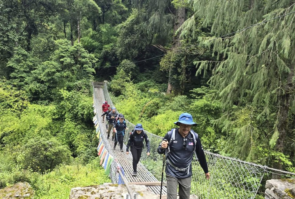
The trekking begins along the Budhi Gandaki River, following narrow cliffside trails carved into steep terrain. The path constantly rises and falls, crossing suspension bridges and passing small settlements built into the hillsides.
The trail passes Khorlabesi and Tatopani, a natural hot spring area where trekkers often stop for rest. From here, the valley becomes narrower and more dramatic, with steep rock walls rising on both sides.
Jagat is a beautifully structured stone village and an important checkpoint where permits are officially verified before entering the restricted Manaslu region.
- Trek distance: 22 km
- Trek duration: 6-7 hours
- Altitude gain: +440m
- Overnight: Jagat
Day 3: Jagat – Deng (1,860m)
Today marks a visible shift in culture and landscape. The lower Hindu-influenced settlements slowly disappear, replaced by Tibetan Buddhist cultural elements such as mani walls, prayer flags, and chortens.
The trail moves through Philim, a large Gurung village where trekkers usually take a break before continuing deeper into the valley. Beyond Philim, the trail becomes more isolated, entering bamboo forests and narrow gorge sections.
Deng is a quiet and remote settlement surrounded by forested hills and river valleys, giving a strong feeling of entering the deep Himalayas.
- Trek distance: ~20 km
- Trek duration: 6-7 hours
- Altitude gain: +520m
- Overnight: Deng
Day 4: Deng – Namrung (2,630m)
The trail becomes steeper and more alpine as you gain altitude. Forests transition from subtropical vegetation into pine and rhododendron zones. The air becomes noticeably cooler, and Himalayan peaks begin appearing in the distance on clear days.
This section of the trek includes multiple suspension bridge crossings, forest climbs, and ridgeline walking sections. The terrain feels more rugged and less populated compared to lower valleys.
Namrung is a well-developed village with strong Tibetan cultural influence and offers the first clear panoramic views of Himal Chuli and surrounding peaks.
- Trek distance: 19 km
- Trek duration: 6–7 hours
- Altitude gain: +770m
- Overnight: Namrung
Day 5: Namrung – Lho (3,180m)
Today the scenery becomes significantly more dramatic as the trail climbs into higher Himalayan terrain. The valley opens up and snow-covered peaks begin to dominate the skyline.
Lho is one of the most scenic villages on the entire Manaslu Circuit, known for its monastery and wide mountain views. The landscape here feels open, spiritual, and deeply connected to Tibetan Buddhist traditions.
One of the most memorable moments of the trek occurs here, the first clear and close view of Mount Manaslu (8,163m), rising directly above the valley.
- Trek distance: 10 km
- Trek duration: 4-5 hours
- Altitude gain: +550m
- Overnight: Lho
Day 6: Lho – Samagaun (3,530m)
The trail today is relatively moderate and highly scenic, passing through open alpine valleys surrounded by towering Himalayan peaks. The walk feels immersive, with continuous views of Manaslu, Himal Chuli, and glacial ridges.
A major stop along the route is Shyala village, one of the most picturesque settlements in the region, surrounded by 360-degree mountain panoramas.
Samagaun is the largest and most important village in the Upper Manaslu region, serving as the cultural and logistical hub for trekkers.
- Trek distance: 17 km
- Trek duration: 4-5 hours
- Altitude gain: +350m
- Overnight: Samagaun
Day 7: Acclimatization Day- Samagaun (3,530m)
Today is an important acclimatization day in Samagaon. You will do short hikes to help your body adjust to the high altitude before going higher on the Manaslu Circuit Trek. This rest and hike balance reduces the risk of altitude sickness.
You can explore nearby places like Pungyen Monastery, Birendra Lake, or the Manaslu Base Camp viewpoint. The area offers amazing views of Mount Manaslu and surrounding glaciers while giving you time to rest and recover.
Day 8: Samagaun – Samdo (3,860m)
The trail gradually climbs into a more barren and high-altitude environment. Vegetation becomes sparse, and the valley widens into an open alpine landscape.
Samdo is a small settlement located near the Tibetan border and is one of the last inhabited villages before entering the high pass region. Life here is simple, heavily influenced by yak herding and traditional mountain culture.
The sense of isolation becomes more intense as trekkers move deeper into the restricted Himalayan zone.
- Trek distance: 8 km
- Trek duration: 3-4 hours
- Altitude gain: +330m
- Overnight: Samdo
Day 9: Samdo – Dharamsala / Larkya Phedi (4,460m)
This is a short but very important high-altitude trekking day. The trail ascends gradually through dry, rocky terrain with minimal vegetation.
Dharamsala, also known as Larkya Phedi, is the final stop before crossing Larkya La Pass. Accommodation is basic, and conditions become noticeably colder and harsher.
Most trekkers rest early to prepare for the early morning ascent to the highest point of the trek.
- Trek distance: 6-7 km
- Trek duration: 4-5 hours
- Altitude gain: +600m
- Overnight: Dharamsala
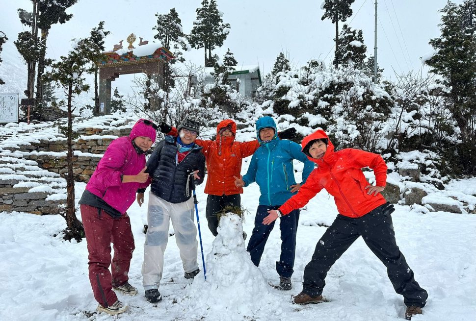
Day 10: Larkya La Pass (5,106m) – Bimthang (3,720m)
This is the most physically and mentally demanding day of the entire trek. The ascent begins before sunrise in freezing temperatures, with slow and steady climbing required due to high altitude and thin oxygen levels.
The view from Larkya La Pass is one of the most spectacular in Nepal, offering panoramic scenery of Himlung Himal, Cheo Himal, Kang Guru, and the Annapurna range.
After spending a short time at the pass, a long and steep descent begins toward Bimthang, crossing glacier moraines and rocky valleys.
- Trek distance: 24 km
- Trek duration: 8-10 hours
- Highest point: 5,106m
- Overnight: Bimthang
Day 11: Bimthang – Tilije (2,300m) – Jeep to Besisahar via Dharapani
After crossing the high pass, the trail descends into dramatically different terrain. Alpine landscapes slowly transition into green forests filled with rhododendron and pine trees.
Rivers reappear, temperatures rise, and oxygen levels improve significantly, making walking easier and more comfortable. This section feels like a gentle return from the extreme high Himalayas back into lower, livable valleys.
Tilije is a peaceful traditional village that marks the end of the upper Manaslu trekking region and the beginning of easier, road-connected settlements.
From Tilije, the trail continues down to Dharapani, where the trekking route officially connects with the road network. From Dharapani, trekkers usually take a shared or private jeep to Besisahar, which marks the end of the mountain road journey.
- Trek distance: ~20 km
- Trek duration: 5–6 hours
- Altitude loss: -1,420m
- Drive distance (Dharapani → Besisahar): ~45–50 km
- Driving time: 4–6 hours (depending on road condition and season)
- Overnight: Besisahar
Day 12: Besisahar – Kathmandu
The trek ends with a long drive back to Kathmandu. The route follows mountain roads, river valleys, and rural settlements before re-entering the capital city.
The transition from remote Himalayan wilderness to urban environment feels sudden, marking the end of a complete circuit experience.
- Driving distance: ~200–220 km
- Driving time: 8–10 hours
- End of trek
It remains one of the most efficient and widely used itineraries for completing the Manaslu Circuit safely and successfully. If you’re wondering about the Manaslu Circuit Trek difficulty, it is generally considered a challenging trek due to its remote terrain, long walking days, and high-altitude passes, especially the crossing of Larkya La Pass. However, with proper preparation, a good itinerary, and steady acclimatization, it is achievable for trekkers with a reasonable level of fitness.
Before and After the Manaslu Circuit Trek – Staying in Kathmandu
Most trekkers don’t jump straight into the Manaslu Circuit Trek the moment they land in Nepal, and honestly, that’s a good thing. Kathmandu is not just a transit city; it’s a cultural experience on its own and an important part of your overall Himalayan journey.
Before planning your itinerary, one of the most important things to consider is the best time for the Manaslu Circuit Trek. Choosing the right season is just as crucial as selecting the route itself, as weather conditions, visibility, and trail safety can significantly impact your overall experience.
Before the trek begins, it is highly recommended to spend at least 1–2 days in Kathmandu. This gives you time to recover from international travel, adjust to the time zone, and prepare mentally for the remote mountain journey ahead. During this time, your trekking agency usually finalizes permits, checks your gear, and introduces you to your guide. It is also the perfect opportunity to do last-minute shopping in Thamel, where you can find trekking equipment, snacks, SIM cards, and gear rentals at reasonable prices.
Kathmandu itself offers plenty to explore even in a short stay. Many trekkers choose to visit UNESCO World Heritage Sites such as Swayambhunath (Monkey Temple), Boudhanath Stupa, and Pashupatinath Temple, which give a deep insight into Nepal’s spiritual and cultural identity. These visits are not just sightseeing stops—they help you understand the cultural richness that you will later experience in Tibetan-influenced villages during the Manaslu trek.
After completing the trek, returning to Kathmandu feels completely different. The noise, traffic, and energy of the city contrast sharply with the silence and simplicity of the mountains. This post-trek phase is often when trekkers reflect on their journey—the long walking days, the high mountain pass, and the remote villages that felt like another world.
Many travelers choose to stay an extra 1–3 nights after the trek to rest, enjoy good food, and explore more of Kathmandu Valley. Popular post-trek activities include visiting Bhaktapur Durbar Square, exploring Patan’s ancient architecture, or simply relaxing in Thamel cafés while looking back at photos from the mountains.
Whether before or after the trek, Kathmandu is not just a stopover—it is an essential part of the Manaslu Circuit experience that connects city life with Himalayan adventure.
Customizable Manaslu Circuit Trek Itinerary (Flexible Travel Plan)
The 12-day Manaslu Circuit Trek itinerary shared above is designed as a standard and well-balanced route, based on the most commonly followed trekking plan used by guides and agencies in Nepal. However, it is important to understand that this itinerary is not fixed or rigid.
Every trekking journey in the Manaslu region can be fully customized according to your time, fitness level, experience, and travel style.
Some trekkers prefer a faster version (12–13 days) by combining shorter walking sections, especially in the lower regions. Others choose a more relaxed itinerary (15–16 days), adding extra acclimatization days in places like Samagaun or adjusting walking hours to enjoy the scenery at a slower pace. The route can also be modified based on weather conditions, group size, and road accessibility at the beginning and end of the trek.
In reality, the itinerary provided here should be seen as a basic framework or reference plan, not a strict schedule. Your guide or trekking agency can adjust daily distances, overnight stops, and pacing depending on real-time conditions in the mountains.
This flexibility is one of the strengths of the Manaslu Circuit Trek. It allows trekkers to design a journey that matches their comfort level while still experiencing the same breathtaking landscapes, cultural villages, and high mountain passes.
Whether you follow a standard 14-day plan or customize it slightly, the core experience remains the same, a remote Himalayan adventure through one of Nepal’s most untouched trekking regions.
Manaslu Circuit Trek Itinerary FAQs
1. How many days are needed for the Manaslu Circuit Trek?
The standard Manaslu Circuit Trek takes 12 to 14 days, depending on your pace, acclimatization days, and itinerary customization. Some fast trekkers complete it in 10–11 days, but 12–14 days is recommended for safety and proper altitude adjustment.
2. What is the best Manaslu Circuit Trek itinerary?
The best itinerary is the 12–14-day route, which includes proper acclimatization in Samagaun and Samdo before crossing Larkya La Pass (5,106m). This is the most balanced plan for safety, scenery, and success rate.
3. Is 12 days enough for the Manaslu Circuit Trek?
Yes, 12 days is enough for fit and experienced trekkers, but it is a faster itinerary. Most beginners prefer 13-14 days to reduce altitude sickness risk and enjoy the journey more comfortably.
4. What is the highest point in the Manaslu Circuit Trek itinerary?
The highest point is Larkya La Pass at 5,106 meters, which is also the most challenging and scenic part of the entire trek.
5. Can the Manaslu Circuit Trek itinerary be customized?
Yes, the itinerary is fully customizable depending on your fitness level, time availability, and weather conditions. You can shorten or extend the trek with agency support.
6. What is the hardest day in the Manaslu Circuit Trek itinerary?
The hardest day is crossing Larkya La Pass (Day 9 in most itineraries). It involves a long 8–10-hour trek at high altitude with steep ascent and descent.
7. Why do trekkers stay in Samagaun in the itinerary?
Samagaun is an important acclimatization stop. It helps your body adjust to high altitude before moving toward Samdo and Larkya La Pass.
8. Is Samdo included in all Manaslu itineraries?
Most standard itineraries include Samdo, but in some shorter versions it may be skipped. However, staying in Samdo helps improve safety before the pass crossing.
9. Where does the Manaslu Circuit Trek start and end?
The trek usually starts at Machha Khola or Soti Khola and ends at Dharapani, followed by a drive to Besisahar and Kathmandu.
10. How long is the trekking distance in Manaslu Circuit itinerary?
The total trekking distance is approximately 170–180 km, depending on side routes and itinerary variations.
11. What is the best route for Manaslu Circuit Trek itinerary?
The most common and best route is:
Kathmandu – Machha Khola – Jagat – Deng – Namrung – Lho – Samagaun – Samdo – Larkya Phedi – Bimthang – Tilije – Dharapani – Kathmandu
12. Is it safe to follow a 12-day Manaslu itinerary?
Yes, but it is recommended for experienced or physically fit trekkers. If beginners should choose a longer 13–14-day itinerary for better acclimatization.
13. Do I need a guide for the Manaslu Circuit Trek itinerary?
Yes, a licensed guide is mandatory for the Manaslu Circuit Trek as it is a restricted area. Solo trekking is not allowed without proper authorization.
14. What is the best time for Manaslu Circuit Trek itinerary?
The best seasons are spring (March–May) and autumn (September–November) when weather conditions are stable and mountain views are clear.
15. Can I combine Manaslu Circuit Trek with Annapurna Circuit?
Yes, the itinerary naturally connects at Dharapani, making it possible to extend into the Annapurna Circuit or shorten the trek depending on your plan.